


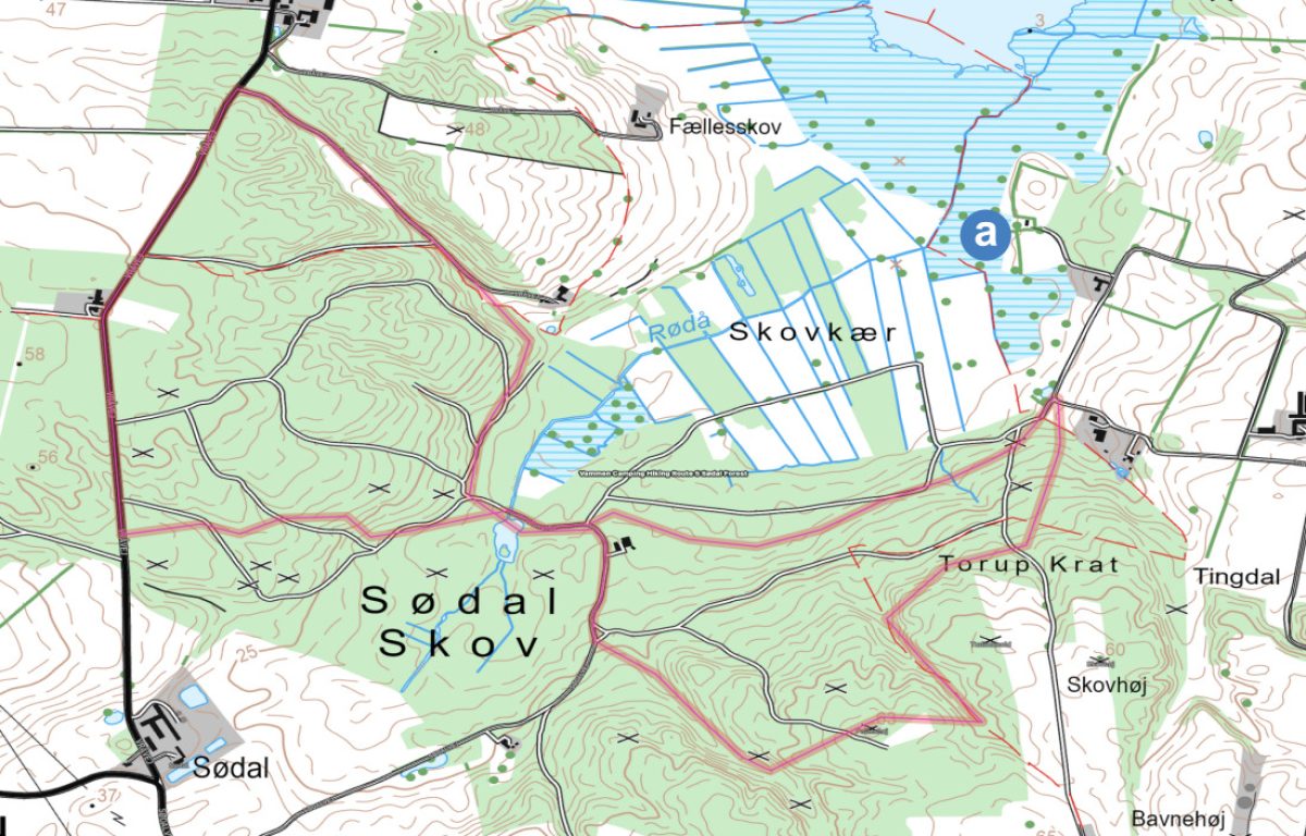
Length 6.9 km
Explore the landscape around Rødsø and into Sødal Forest, where traces of the Stone Age are hidden between lake, forest and old sawmill stories. A route full of views, ancient monuments and opportunities for peace and contemplation in nature.
Follow the camping road towards Vammen and keep left in the Y-junction. Turn left onto Hobrovej. At the grocery store intersection, turn right onto Nørregade. Turn left onto Haugårdsvej – you’ll pass Langsø Friskole, kindergarten and nursery on your right and continue straight ahead along Haugårdsvej. The route now has purple markers.
Behind the Havgård farm (Haugårdsvej 44) are the remains of a nozzle chamber. Today, only two supporting stones and a fallen lintel remain. The stone pit probably had a single chamber, which was placed in the burial mound with a stone foot circle around it. The ditch is a common grave – probably built in the Early Stone Age or some time into the Middle Stone Age. (approx. 8,300 – 4,000 BC).
From here you have a beautiful view of Rødsø. A small lake with a wide reedbed that is in the process of regenerating.
Follow the purple marked route towards Sødal Skov and enter Sødal Skov along the forest road after Haugårdsvej 46 (where Haugårdsvej and Tinghøjvej meet).
Sødal Forest is a privately owned forest of approximately 180 hectares and thus without marked routes. You can use the map of Sødal Forest from the campsite’s website (in the printed material it can also be found on the back). You are welcome to walk on all forest trails – except on hunting days.
Sødal Forest is a beautiful small mixed forest.
In the middle of the forest is a now defunct sawmill. It was powered by an old 1-cylinder kerosene engine (Deutz engine) from around 1900.
All the timber for the sanitary building at the campsite was cut here.
In the forest there are approximately 20 burial mounds/nozzles from the Neolithic period (ca. 2500 – 1800 BC). The building stone is an upright, often carved stone that was frequently erected in the Bronze Age in Western Europe as a memorial stone or landmark.
Return to the starting point at Haugårdsvej/Tinghøjvej and turn right onto Tinghøjvej. Turn right at the Tingdalgård farm and follow the gravel road along the small marked route to Hobrovej. Follow the paved bike/hiking path to the left back to Vammen. At the junction by the grocery store, continue straight ahead and turn right at Langsøvej. Follow this back to the campsite.
a) The technical feasibility studies for a major new “Rødsø Lowlands Project” have just started. The aim is to restore the natural hydrology in an area of 650 hectares, thereby reducing greenhouse gas emissions and reducing nitrogen emissions. In addition, the project will focus on improving the overall natural conditions in the area.
Map of Sødal Forest
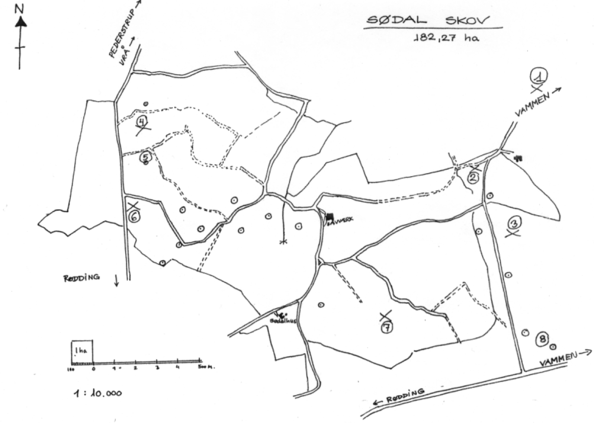
⊙ = Barrow X = ancient monument
1) A small mound with a nozzle chamber at the top, 2 large supporting stones and a fallen lintel.
2) A building stone, approx. 1.5 m high above ground, approx. 0.5 m below ground level; the cross section is approx. 1 m.
3) A very small, well-preserved nozzle made of 3 small supporting stones and a lintel barely 1 m in diameter.
The mound itself is only 0.5 m high and 5 m across. Probably a child’s grave.
4) Remains of a passage grave. 8 stones are still in place, but no lintels.
5) Pristine round mound in forest.
6) A nozzle chamber in the northwest-southeast. Two large side stones.
7) A small stone chamber.
8) Two untouched well-preserved mounds; the westernmost is called “Bavnehøj”.
9) A mound “Uglhøj”, enclosing two passage graves with entrance from the southeast.